The TaxView application offers a map-based view of tax parcel information that enables supporting agencies, organizations and the general public to locate an area of interest and review common information stored in Roanoke County’s computer aided mass appraisal (CAMA) and tax receivables database.
TaxView offers a standard overview of property data for real estate professionals and other consumers.
Users
can search for a specific address, owner or parcel number, view authoritative property characteristics, sales information, and email this information, if
desired. Users can also provide feedback to Roanke County to improve the quality of parcel
information.
This GIS Application works in the following Browsers ONLY:
Microsoft Internet Explorer 9+, Mozilla Firefox, Apple Safari and Google Chrome.There are three primary ways to identify an area of interest:
1. Interact directly with the map by panning and zooming and clicking on a parcel when you've located the correct location.
2. Use your current location (best results on a mobile device with location services enabled).
3. Use the Search box to
search for a parcel using an address, parcel identification (Parcel ID) number, name of the owner (Last Name First Name) or common name (Cave Spring High School).
There are several ways to interact with the map:
1. Use the base map switcher  to select the base map or layers with which you'd like to view/interact.
2. Hold down the shift key and drag a box on the map to zoom in.
3. Hold
down Ctrl+Shift to zoom out.
4. Roll your mouse scroll wheel to zoom in/out.(Known
Issue: Under Internet Explorer 11, the mouse-wheel will only zoom in,
regardless of the rotation direction.)
5. Click the +/- to zoom in/out.
6. Click the home button  to zoom out to the full map extent.
 Searching
The Search box can be used to find a parcel. Search uses an autocomplete feature that will make suggestions in a drop down window as you type in the Search box.
1. Enter a complete or partial address, Parcel ID, Owner name or Place Name .
2. Click the item in the
drop down list to locate and zoom into the parcel on the map.
3. You may also locate a parcel via your location (applicable for mobile devices
with location services enabled only) by clicking the  icon.
icon.
If you choose a parcel, from a listing with multiple returns, and wish to return to the list, click the  icon at the top of the information pane.
After searching for a parcel and selecting it from the list, the parcel will be highlighted on the map. Relevant information will be presented in the information pane:
1. In the Property tab, you'll find tax parcel information, provided by Roanoke County.
2. In the Zoning tab, you'll find zoning codes, descriptions, action and ordinance information.
3. In the Broadband tab you'll find broadband availability information provided by the National Broadband Map.
 Standard Maps and Property Reports
Tax Parcel Viewer also provides users a standard set of parcel maps and reports. When a user accesses the Tax Parcel Viewer on a desktop PC or tablet device, maps and a property report can be generated
by selecting:
Create Property Report - The Parcel ID and Address are passed to the report. You may select the image to show on the first page of the report and to include a variety of information. The preview images are live and may be manipulated for better viewing (Zoom in/out, moved and even rotated (if applicable)). Press "Create Report" to start the process and it will open a new tab or page with the report.
Known Issue: The Firefox browser may show black boxes where links are placed. This is a browser rendering issue, however, the links do work when you mouse-over them. The links will show up properly in Adobe Acrobat.
Create Property Map - By selecting a layout and furnishing a title, you can create a map based on what is appearing on the screen. The
result will include the screen information, date printed and scale bar/text.
Known Issues: If your map fails to appear, please check your pop-up blocker settings. Also, in Firefox, when a map is generated the text may look scrambled. When the map is saved and opened as a PDF, the text will be correct.
This is a browser rendering issue, not a problem with the application. Please associate PDF's with Adobe Acrobat and not "Preview in Firefox".
 Submit Feedback
If you feel there may be a boundary, characteristic, or other problem with a particular parcel, click the Submit Feedback button. You'll be prompted to select the type of feedback, draw the location on the map, enter your comments, and provide your contact information
for follow-up.
Click the Submit button when you're finished.
 Basemaps
 Hybrid - 2011 Aerial imagery overlay
that includes roads, points of interest, parcel information and water features.
Hybrid - 2011 Aerial imagery overlay
that includes roads, points of interest, parcel information and water features.  Streets - A layer which depicts roads, schools, parks, parcel lines, building footprints and water features with a hillshaded underlay.
 Tax Map - A layer which depicts streets, parcel lines/information, addresses, tax grid, water features and lot dimensions.
 Imagery - 2011 Aerial imagery.
Back
Layers
Floodway - This shows FEMA's study of the fastest flow of water should there be a flood incident.
Commercial Sales - Sales of Commercial property within the last six months, according to the present data. Properties will automatically roll out of view after 180 days from
the date of posting.
100 Year Flood Plain - This shows FEMA's study of the possible ponding that develops during a one hundred year storm flood incident.
Residential Sales - Sales of Residential property within the last six months, according to the present data. Properties will automatically roll out of view after 180 days, from
the date of posting.
Land Sales
- Sales of Land within the last year, according to the present date. Properties will automatically roll out of view after 365 days, from date of posting.
 Share Your Map
With Share Maps you can send your map by email, post to Facebook or Twitter. When you use the Facebook or Twitter links, you'll be asked to sign in to your respective account.
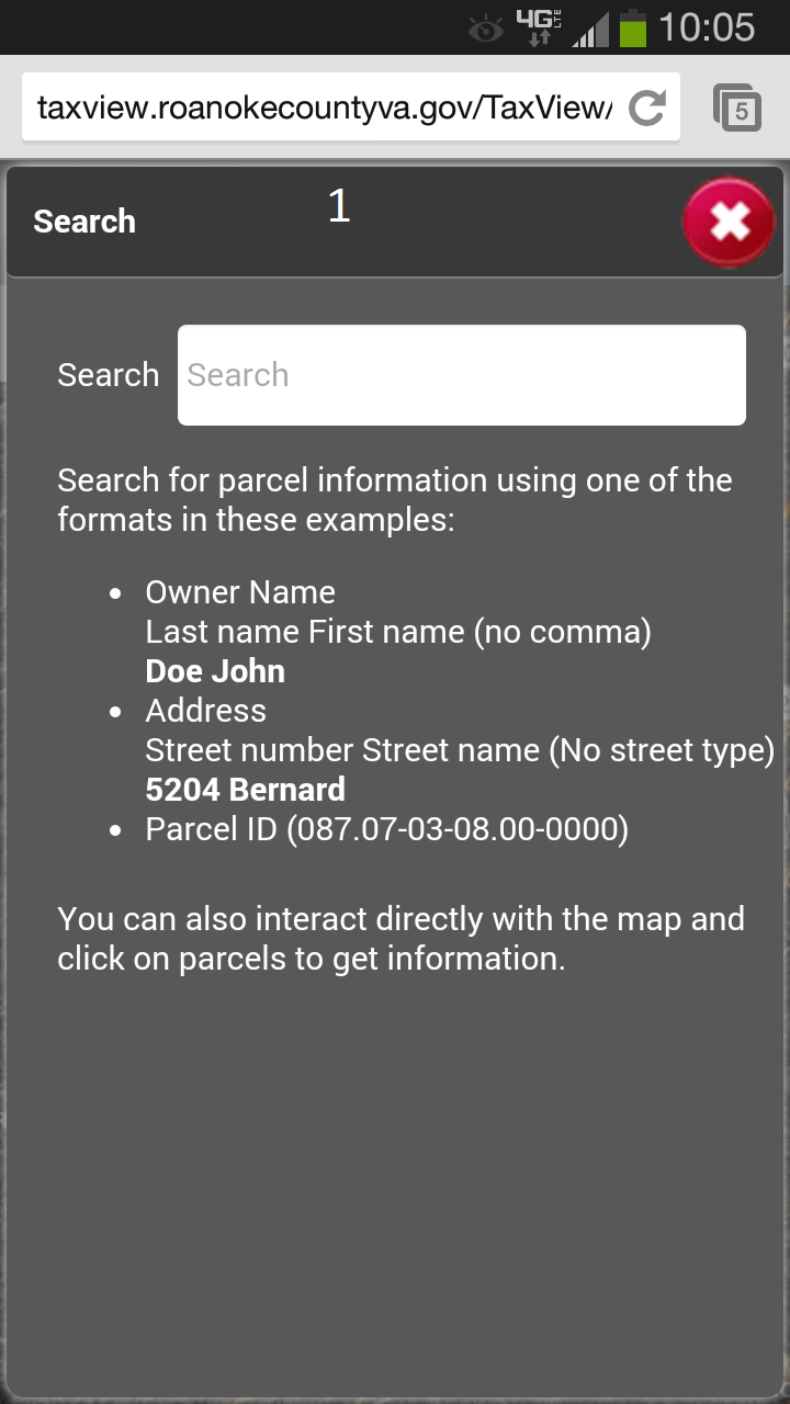
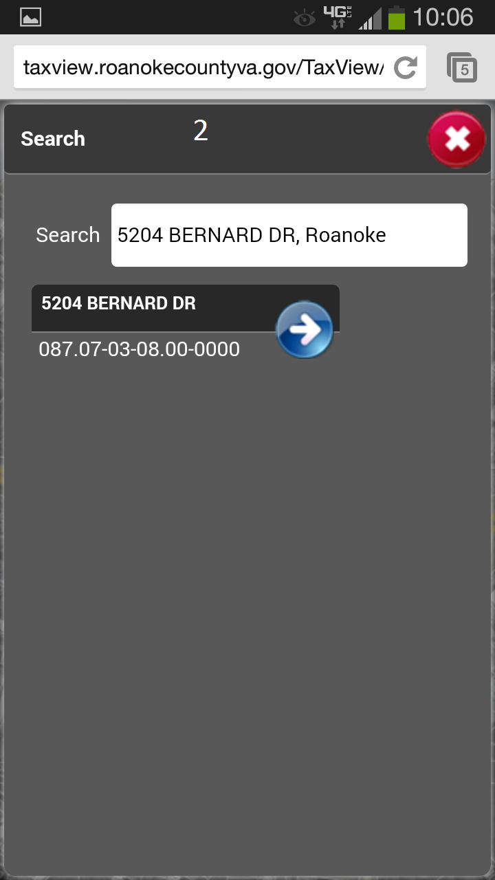
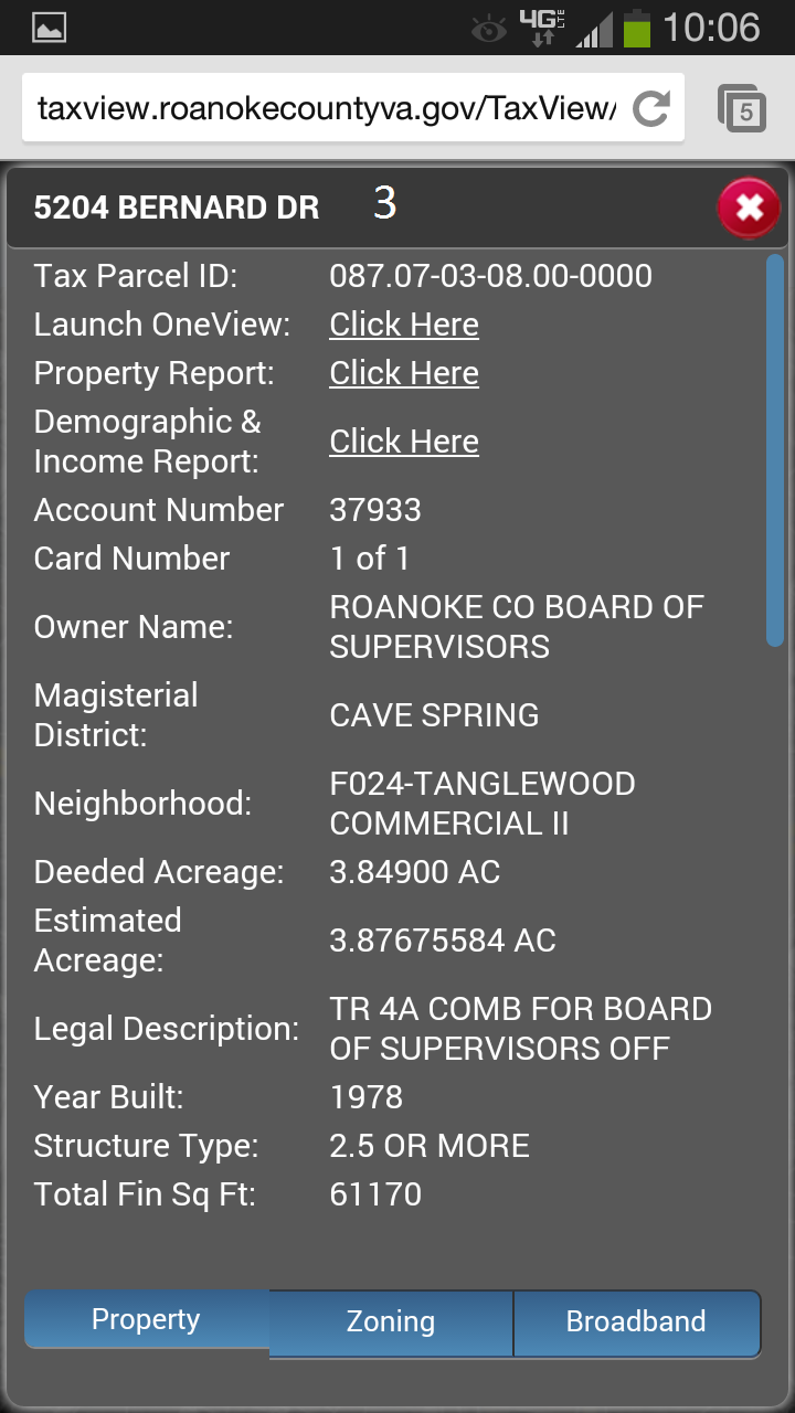
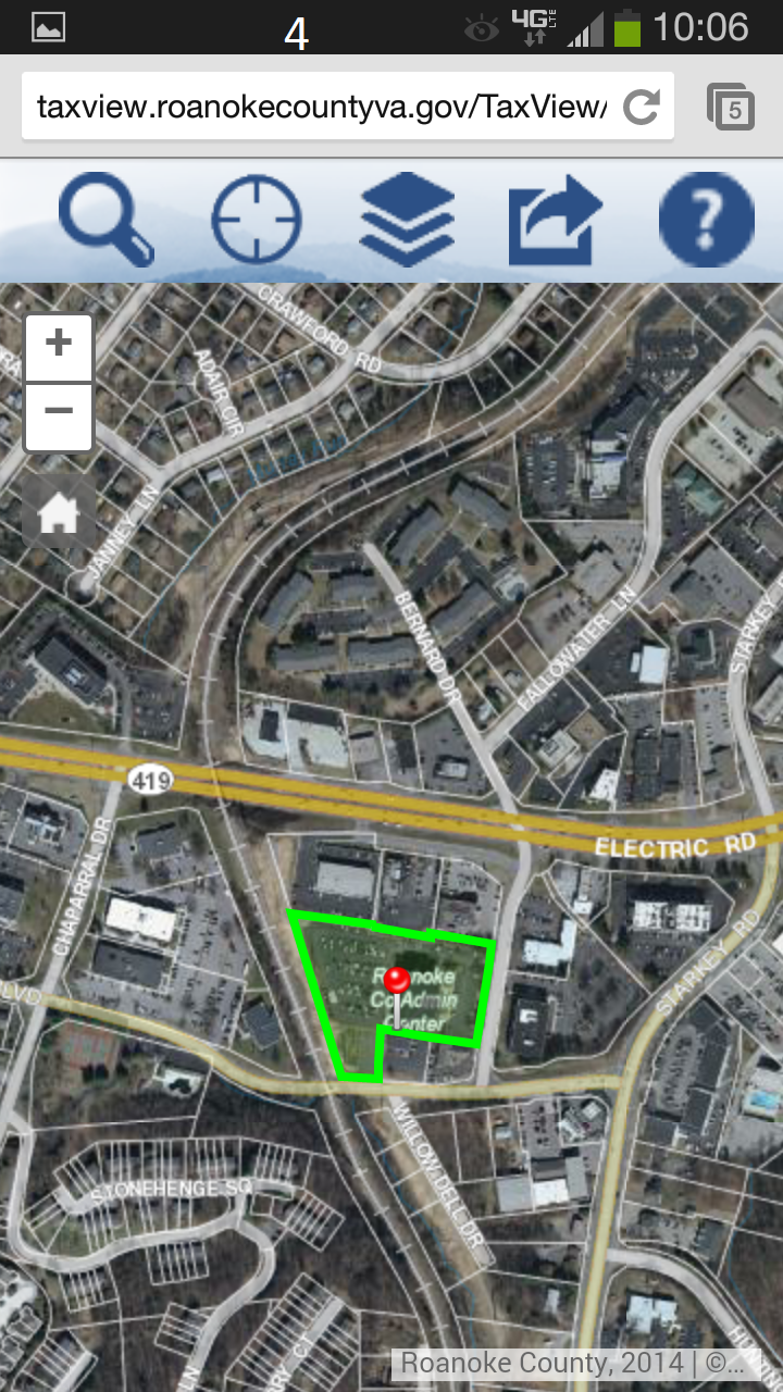
BackThere is a difference between the Desktop and Mobile formats in relation to searching and displaying of information. Below shows an example of how the information is returned and how to navigate through the different screens to access the map portion of the application
1. This is the screen that opens when you tap the search icon and where you enter the Address, ParcelID, Owner Name or Common Name
2. The initial search return screen where you can click on the search return
3. The search result information screen that displays the real estate information and related links for advanced features
4. The map with the selected parcel outlined in green
To navigate to 4, you have to close each individual screen by clicking the close icon